Food Security and Resilience Copernicus Hackathon
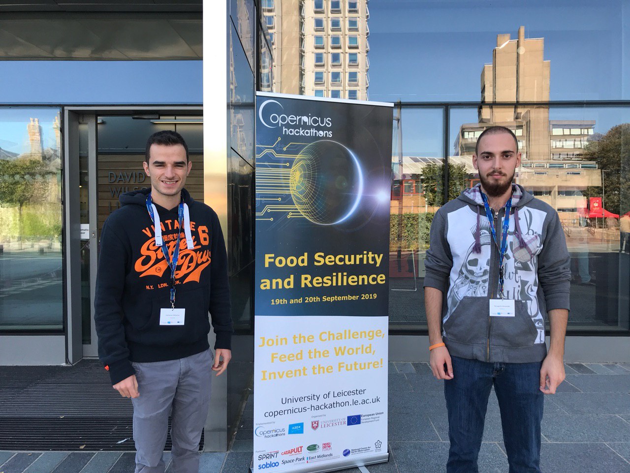
A 48-hour collaborative hackathon at the University of Leicester bringing together coders, researchers, scientists, designers and problem-solvers to develop solutions for food security and resilience using Copernicus Earth observation data.
Food Security and Resilience Copernicus Hackathon
Feed the World, Invent the Future
The Food Security and Resilience Copernicus Hackathon was a two-day collaborative innovation event held at the University of Leicester on 19–20 September 2019.
Bringing together coders, researchers, scientists, designers, storytellers, entrepreneurs and problem-solvers, the hackathon challenged participants to use Copernicus Earth observation data and services to develop practical solutions to challenges surrounding food security, water security and resilience in a changing climate.
Over an intensive 48 hours, multidisciplinary teams developed prototypes, explored new applications for satellite data and investigated opportunities for collaboration between academia, industry and the wider community.
About the Hackathon
The event was built around a simple challenge:
Feed the World, Invent the Future
Food security requires people to have access to sufficient, safe and nutritious food while ensuring that food systems remain sustainable into the future.
Achieving this requires better understanding of the environmental, economic and societal pressures affecting food production and consumption.
The hackathon provided a practical environment in which participants could explore how Earth observation and space-enabled technologies could contribute to addressing these challenges.
Objectives
The hackathon was designed around several interconnected objectives.
Developing Solutions
Develop new solutions addressing local and global food and water security challenges, with a particular emphasis on resilience and sustainability.
Raising Awareness
Increase awareness of the University of Leicester’s work supporting:
- UK and European space programmes
- Environmental monitoring
- Security and resilience
- Earth observation
- Food and drink industries
- Space-enabled innovation
Connecting Students and Industry
Give students and early-career participants the opportunity to work on real-world challenges while connecting them with businesses, researchers and wider professional networks.
Building Collaboration
Use the Copernicus Hackathon as a mechanism for creating new collaborations between:
- Academia
- Industry
- Government
- Students
- Researchers
- Entrepreneurs
- Technology developers
- End users
Copernicus and Earth Observation
The hackathon centred on the Copernicus programme, the European Union’s Earth observation programme.
Copernicus provides access to extensive environmental data and services derived from satellites, in-situ observations and other sources.
Participants were encouraged to explore how this open data could be transformed into useful applications and services.
Potential applications included:
- Agriculture
- Food production
- Water security
- Environmental monitoring
- Climate resilience
- Logistics
- Supply chains
- Resource mapping
- Risk assessment
- Insurance
- Smart cities
- Decision support
The emphasis was not simply on analysing satellite data, but on turning Earth observation into practical solutions.
Challenge Themes
Participants could select their own challenge within the broad theme of food and water security and resilience.
Suggested areas included:
Smart Agriculture
Using Earth observation and other technologies to improve agricultural decision-making, productivity and resilience.
Logistics and Supply Chains
Exploring how satellite data, logistics technologies and emerging digital infrastructure could improve food supply chains.
Blockchain and Food Security
Investigating potential applications of distributed technologies in food and water supply chains, provenance and resilience.
Smart Insurance
Developing new services that could use Earth observation data to understand environmental risks and support innovative insurance products.
Resource Mapping
Using satellite observations to map, monitor and understand environmental and agricultural resources.
Societal and Technical Challenges
Participants were also encouraged to identify their own challenges relevant to food security, water security and resilience.
The 48-Hour Challenge
The core hackathon took place over 19 and 20 September 2019.
Teams worked intensively over two days to move from an initial problem or idea towards a practical prototype.
The process encouraged rapid experimentation and multidisciplinary collaboration.
Participants combined:
- Copernicus data
- Coding
- Data analysis
- Design
- Research
- Business modelling
- Storytelling
- Domain expertise
The objective was to produce something tangible rather than simply discuss potential applications.
Rapid MVP Development
Participants received preparatory training before the main event.
A training session on 12 September 2019 introduced selected teams and other participants to:
- Agile development
- Rapid MVP development
- Copernicus data access
- Relevant coding libraries
- Rapid prototyping approaches
This provided teams with a common foundation before the 48-hour event.
The focus on minimum viable products (MVPs) helped participants move rapidly from ideas towards demonstrable concepts.
Knowledge Exchange
The hackathon was designed as a knowledge-exchange activity rather than a conventional coding competition.
It brought together people with different skills and perspectives, allowing technical expertise to be combined with knowledge of food systems, Earth observation, business and societal challenges.
This multidisciplinary approach was central to the event.
A successful solution could require expertise from several different domains, for example:
Satellite data + agriculture + software + business + user needs
rather than technology development in isolation.
University of Leicester
The hackathon took place at the University of Leicester, drawing on the University’s established expertise in space science, Earth observation and environmental research.
The venue was:
David Wilson Library
University Road
Leicester
LE1 7RH
United Kingdom
The event also formed part of Leicester’s wider development as a centre for space-enabled innovation.
Organisers and Sponsors
The hackathon was supported by a network of organisations from the space, Earth observation, food, research and innovation communities.
Sobloo
Sobloo supported the Copernicus programme by providing access to Copernicus data through cloud computing infrastructure.
SPRINT
SPRINT connects businesses with expertise and facilities at leading UK space universities, helping organisations develop products and services based on space data and technologies.
Partners
The wider partnership included organisations representing research, government, food systems, Earth observation and space-enabled innovation.
European Regional Development Fund
The European Regional Development Fund (ERDF) supported economic, social and territorial cohesion and initiatives focused on smart, sustainable and inclusive growth.
Leicester City Council
The Smart Cities team at Leicester City Council works with businesses, universities and other partners to develop smart solutions to challenges facing the city.
National Centre for Earth Observation
The National Centre for Earth Observation (NCEO) provides UK expertise in Earth observation science, datasets, data integration and environmental modelling.
Global Food Security
Global Food Security (GFS) facilitates interdisciplinary research and collaboration addressing challenges across food systems.
CoRdiNet
CoRdiNet is an open network of Copernicus Relays supporting the promotion and development of digital and commercial applications based on Earth observation data.
Food and Drink Forum
The Food and Drink Forum Ltd supports and develops food enterprises while representing the food and drink industry at local and regional levels.
East Midlands Centre of Excellence in Satellite Applications
The East Midlands Centre of Excellence in Satellite Applications connects academic research with industry and SMEs to support the development and commercialisation of space-enabled applications.
Space Park Leicester
Space Park Leicester was established as an ambitious hub for businesses, researchers and academia working with space and space-enabled technologies.
The initiative was intended to support:
- Earth observation
- Space data analysis
- Commercialisation
- Space mission development
- Research collaboration
- Innovation
Satellite Applications Catapult
The Satellite Applications Catapult works to help organisations harness satellite-based services and bring new applications and products to market.
Its role includes connecting industry and academia and helping research move towards commercial application.
Mentoring
The event was supported by a multidisciplinary group of mentors drawn from industry, academia and the space sector.
Mentors included:
- Ayo Akinduko
- Paul Bhatia
- Joseph Bray
- David Cassell
- Steven Hancock
- Neil Humpage
- Ryan Laird
- David Large
- Carmine Maffei
- Jan Oliver Ringert
- John Roberts
- Maria Touri
- Dr Tim Trent
- Fabio Domenico Vescovi
The mentoring model gave participants access to expertise beyond their individual teams and helped bridge the gap between technical development, research and potential real-world applications.
My Role
I participated as a mentor, supporting teams during the hackathon and contributing to the wider knowledge exchange around space-enabled applications.
The role involved helping participants think through the practical application of Copernicus data and the development of solutions that could address real-world challenges.
This included supporting teams as they moved through the rapid development process and helping connect technical possibilities with user needs and wider applications.
From Data to Impact
A central theme of the hackathon was the transformation of raw Earth observation data into useful information and ultimately actionable solutions.
The process can be represented as:
Earth observation data → Information → Insight → Application → Impact
Copernicus provides the data infrastructure, but the value emerges when that data is combined with domain knowledge, software, business models and an understanding of user needs.
The hackathon provided a practical environment for exploring this transition.
Food Security and Resilience
Food security is not simply a question of producing more food.
It is influenced by a complex combination of:
- Climate
- Water availability
- Land use
- Agricultural productivity
- Supply chains
- Infrastructure
- Markets
- Environmental change
- Resource availability
- Human behaviour
Earth observation can provide a powerful perspective because satellites can repeatedly observe large areas of the planet.
This creates opportunities to monitor change, identify risks and support decisions across different scales.
Space-Enabled Innovation
The hackathon demonstrated the potential of space technologies to contribute to challenges far beyond the traditional space sector.
Satellite data can support applications across:
- Agriculture
- Food systems
- Environmental management
- Climate adaptation
- Urban planning
- Logistics
- Insurance
- Emergency response
- Sustainability
The event therefore positioned Copernicus not simply as a source of scientific data, but as an enabling infrastructure for innovation.
Outcomes
The hackathon was designed to conclude with one or more projects developed during the event.
Potential outcomes included:
- New business ideas
- Collaborative research projects
- Software prototypes
- New Earth observation applications
- Academic–industry collaborations
- Follow-on innovation projects
The organising partners provided opportunities for promising concepts to receive further support after the event.
Why the Hackathon Matters
The Food Security and Resilience Copernicus Hackathon demonstrated a model for bringing together space data, multidisciplinary expertise and rapid innovation around a real-world sustainability challenge.
Rather than treating Earth observation as an end in itself, the event focused on the question:
What can we build with this data that makes a difference?
That approach remains relevant as Earth observation becomes increasingly important to climate adaptation, sustainable agriculture, resilience and environmental decision-making.
Legacy
The hackathon formed part of the development of Leicester as a centre for space-enabled innovation and Earth observation applications.
It brought together an unusually broad ecosystem spanning:
University research → Space sector → Earth observation → Food systems → Government → Industry → Students → Entrepreneurs
The event also provided an example of how relatively short, focused innovation programmes can create connections between communities that do not traditionally work together.
Event Summary
| Detail | Information |
|---|---|
| Event | Food Security and Resilience Copernicus Hackathon |
| Dates | 19–20 September 2019 |
| Location | University of Leicester, Leicester, UK |
| Duration | 48 hours |
| Focus | Food security and resilience |
| Technology | Copernicus Earth observation data |
| Format | Multidisciplinary hackathon |
| Approach | Agile / rapid MVP development |
| Role | Mentor |
| Client | University of Leicester |